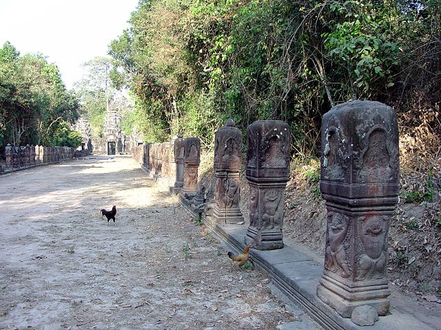
Entrance (East) Causeway
Preah Khan, Angkor, Cambodia
dedicated in 1191

|
Entrance (East) CausewayPreah Khan, Angkor, Cambodia
|
Preah Khan (pronounced "PRAY KAHN") was built by Jayavarman VII, at the west end of the king's Jayatataka baray, on the site of Jayavarman's victory over Cham invaders in 1181. It functioned not only as a temple but also as a monastery and university, including elements of Buddhist, Vaishnava, and Shaiva worship. Jayavarman himself was a Buddhist, but most of the Buddha images were destroyed by his successor Jayavarman VIII, who reverted the temple to exclusively Hindu use.
In plan, the site is a large, east-facing, moated temple/city that is approached by causeway. The city dimensions (fourth enclosure, just inside the moat) are 800m x 700m, which is almost a half-mile on a side. The temple dimensions (third enclosure) are 200m x 175m (650' x 575'). The site is complex, and (deliberately) has been only partially restored. The photographs on these pages begin with the main (eastern) outer entrance, above, and proceed west, more or less down the axis of the site and out the other side.
The photo above was taken from the east, looking down the causeway towards the eastern entrance gopura of the fourth enclosure. Crossing the city moat, the causeway is lined on either side with upright boundary stones (next page).
Preah Khan is managed by the World Monuments Fund.

|

|